Geolocate

Motunga topographic map

Click on the map to display elevation.

About this map

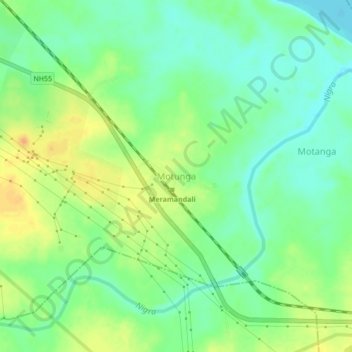
Name: Motunga topographic map, elevation, terrain.

Location: Motunga, Dhenkanal, Odisha, 759121, India (20.78350 85.28583 20.82350 85.32583)

Average elevation: 210 ft

Minimum elevation: 161 ft

Maximum elevation: 269 ft

Gear up for your next adventure:

🧦Hiking Socks - Comfortable socks to prevent blisters on long hikes
🪄Magnetic Compass - Accurate compass for navigation
🔥Camping Stove - Portable stove for camping and backcountry cooking
🧼Biodegradable Camping Soap - Eco‑friendly soap for outdoor hygiene
🚁Photography Drones - Capture stunning aerial views of landforms and topography

As an Amazon Associate, this site earns from qualifying purchases at no extra cost to you.