
Thank you for supporting this site ❤️
Make a donation
Make a donation
Gear up for your next adventure:
As an Amazon Associate, this site earns from qualifying purchases at no extra cost to you.
Cumbicus topographic map
Click on the map to display elevation.
Thank you for supporting this site ❤️
Make a donation
Make a donation
Gear up for your next adventure:
As an Amazon Associate, this site earns from qualifying purchases at no extra cost to you.
About this map
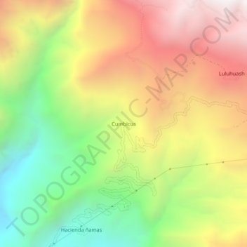
Name: Cumbicus topographic map, elevation, terrain.
Location: Cumbicus, Magdalena, Cajamarca, Perú (-7.23386 -78.65263 -7.19386 -78.61263)
Average elevation: 8,471 ft
Minimum elevation: 5,551 ft
Maximum elevation: 11,522 ft
Thank you for supporting this site ❤️
Make a donation
Make a donation
Gear up for your next adventure:
As an Amazon Associate, this site earns from qualifying purchases at no extra cost to you.