
Thank you for supporting this site ❤️
Make a donation
Make a donation
Gear up for your next adventure:
As an Amazon Associate, this site earns from qualifying purchases at no extra cost to you.
Payao topographic map
Click on the map to display elevation.
Thank you for supporting this site ❤️
Make a donation
Make a donation
Gear up for your next adventure:
As an Amazon Associate, this site earns from qualifying purchases at no extra cost to you.
About this map
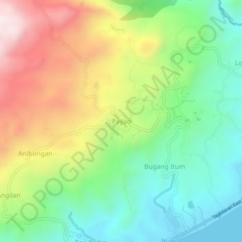
Name: Payao topographic map, elevation, terrain.
Location: Payao, Duero, Bohol, Central Visayas, 6309, Philippines (9.71243 124.38258 9.75243 124.42258)
Average elevation: 994 ft
Minimum elevation: 0 ft
Maximum elevation: 2,539 ft
Thank you for supporting this site ❤️
Make a donation
Make a donation
Gear up for your next adventure:
As an Amazon Associate, this site earns from qualifying purchases at no extra cost to you.