
Thank you for supporting this site ❤️
Make a donation
Make a donation
Gear up for your next adventure:
As an Amazon Associate, this site earns from qualifying purchases at no extra cost to you.
Contlalco topographic map
Click on the map to display elevation.
Thank you for supporting this site ❤️
Make a donation
Make a donation
Gear up for your next adventure:
As an Amazon Associate, this site earns from qualifying purchases at no extra cost to you.
About this map
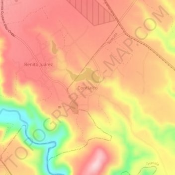
Name: Contlalco topographic map, elevation, terrain.
Location: Contlalco, Tetecala, Morelos, México (18.64019 -99.46343 18.68019 -99.42343)
Average elevation: 3,586 ft
Minimum elevation: 3,091 ft
Maximum elevation: 3,845 ft
Thank you for supporting this site ❤️
Make a donation
Make a donation
Gear up for your next adventure:
As an Amazon Associate, this site earns from qualifying purchases at no extra cost to you.