Geolocate

Talay topographic map

Click on the map to display elevation.

About this map

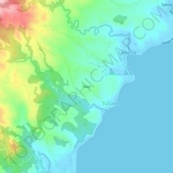
Name: Talay topographic map, elevation, terrain.

Location: Talay, Tubaon, Southern Leyte, Eastern Visayas, Philippines (10.53000 125.14667 10.57000 125.18667)

Average elevation: 177 ft

Minimum elevation: -3 ft

Maximum elevation: 827 ft

Gear up for your next adventure:

🔪Outdoor Multitools - Essential survival tools for gear repair and field use
🕶️Glacier Sunglasses - Side shields to protect eyes from high-altitude snow glare
🧤Tactile Hiking Gloves - Keep hands warm while operating GPS and smartphone screens
🪄Magnetic Compass - Accurate compass for navigation
🧤Hiking Gloves - Protective gloves for rugged trails

As an Amazon Associate, this site earns from qualifying purchases at no extra cost to you.