Geolocate

Kibia topographic map

Click on the map to display elevation.

About this map

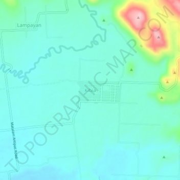
Name: Kibia topographic map, elevation, terrain.

Location: Kibia, Matalam, North Cotabato, Soccsksargen, Philippines (7.14619 124.94284 7.18619 124.98284)

Average elevation: 285 ft

Minimum elevation: 167 ft

Maximum elevation: 778 ft

Gear up for your next adventure:

🛡️Insect Repellent - Protection against bugs during outdoor activities
🔥Fast-Boil Camping Stoves - Efficient cooking systems for quick trail meals
🧦Merino Wool Socks - Moisture-wicking, blister-preventing socks for long treks
🚪Portable Camp Chair - Foldable chair for comfort at camp
📷Action Cameras - Rugged cameras to document your journeys across rugged terrain

As an Amazon Associate, this site earns from qualifying purchases at no extra cost to you.