
Thank you for supporting this site ❤️
Make a donation
Make a donation
Gear up for your next adventure:
As an Amazon Associate, this site earns from qualifying purchases at no extra cost to you.
Cristopamba topographic map
Click on the map to display elevation.
Thank you for supporting this site ❤️
Make a donation
Make a donation
Gear up for your next adventure:
As an Amazon Associate, this site earns from qualifying purchases at no extra cost to you.
About this map
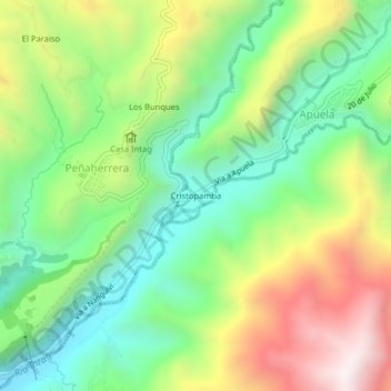
Name: Cristopamba topographic map, elevation, terrain.
Location: Cristopamba, Apuela, Cotacachi, Imbabura, 100305, Ecuador (0.32748 -78.54530 0.36748 -78.50530)
Average elevation: 5,715 ft
Minimum elevation: 4,459 ft
Maximum elevation: 7,690 ft
Thank you for supporting this site ❤️
Make a donation
Make a donation
Gear up for your next adventure:
As an Amazon Associate, this site earns from qualifying purchases at no extra cost to you.