
Make a donation
Gear up for your next adventure:
As an Amazon Associate, this site earns from qualifying purchases at no extra cost to you.
Kavali topographic map
Click on the map to display elevation.
Make a donation
Gear up for your next adventure:
As an Amazon Associate, this site earns from qualifying purchases at no extra cost to you.
Kavali
Kavali is located at 14°54′47″N 79°59′35″E / 14.913001°N 79.992921°E / 14.913001; 79.992921. It has an average elevation of 17 metres (56 ft). The town is at a distance of 8 km from the Bay of Bengal.
Make a donation
Gear up for your next adventure:
As an Amazon Associate, this site earns from qualifying purchases at no extra cost to you.
About this map
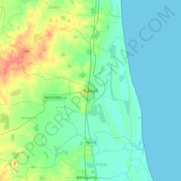
Name: Kavali topographic map, elevation, terrain.
Location: Kavali, SPSR Nellore district, Andhra Pradesh, 524200, India (14.75358 79.83269 15.07358 80.15269)
Average elevation: 49 ft
Minimum elevation: 0 ft
Maximum elevation: 236 ft
Make a donation
Gear up for your next adventure:
As an Amazon Associate, this site earns from qualifying purchases at no extra cost to you.