Geolocate

Patterson topographic map

Click on the map to display elevation.

About this map

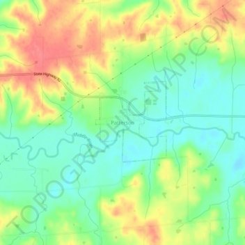
Name: Patterson topographic map, elevation, terrain.

Location: Patterson, Madison County, Iowa, 50218, United States (41.32835 -93.90035 41.36835 -93.86035)

Average elevation: 945 ft

Minimum elevation: 846 ft

Maximum elevation: 1,073 ft

Madison County trails, hiking, mountain biking, running and outdoor activities

Gear up for your next adventure:

📚USA Hiking Guide Books - Top trail guides and map books
🗺️NatGeo Topo Maps - High-quality waterproof printed topographic maps of US Parks
🎒Day Hiking Backpack - Lightweight backpack perfect for day trips and outdoor adventures
🔭Stargazing Telescopes - Perfect for camping in low-light pollution areas shown on maps
🚑Emergency Bivvies - Heat-reflective sleeping bags for survival situations

As an Amazon Associate, this site earns from qualifying purchases at no extra cost to you.