
Thank you for supporting this site ❤️
Make a donation
Make a donation
Gear up for your next adventure:
As an Amazon Associate, this site earns from qualifying purchases at no extra cost to you.
Idabungo topographic map
Click on the map to display elevation.
Thank you for supporting this site ❤️
Make a donation
Make a donation
Gear up for your next adventure:
As an Amazon Associate, this site earns from qualifying purchases at no extra cost to you.
About this map
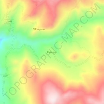
Name: Idabungo topographic map, elevation, terrain.
Location: Idabungo, Huaso, Julcán, La Libertad, Perú (-8.22901 -78.37118 -8.18901 -78.33118)
Average elevation: 12,149 ft
Minimum elevation: 11,198 ft
Maximum elevation: 12,999 ft
Thank you for supporting this site ❤️
Make a donation
Make a donation
Gear up for your next adventure:
As an Amazon Associate, this site earns from qualifying purchases at no extra cost to you.