
Thank you for supporting this site ❤️
Make a donation
Make a donation
Gear up for your next adventure:
As an Amazon Associate, this site earns from qualifying purchases at no extra cost to you.
Cañete topographic map
Click on the map to display elevation.
Thank you for supporting this site ❤️
Make a donation
Make a donation
Gear up for your next adventure:
As an Amazon Associate, this site earns from qualifying purchases at no extra cost to you.
About this map
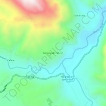
Name: Cañete topographic map, elevation, terrain.
Location: Cañete, Mazamari, Province of Satipo, Junín, Peru (-11.33888 -74.50943 -11.29888 -74.46943)
Average elevation: 2,362 ft
Minimum elevation: 1,601 ft
Maximum elevation: 4,304 ft
Thank you for supporting this site ❤️
Make a donation
Make a donation
Gear up for your next adventure:
As an Amazon Associate, this site earns from qualifying purchases at no extra cost to you.