
Thank you for supporting this site ❤️
Make a donation
Make a donation
Gear up for your next adventure:
As an Amazon Associate, this site earns from qualifying purchases at no extra cost to you.
Oberlungwitz topographic map
Click on the map to display elevation.
Thank you for supporting this site ❤️
Make a donation
Make a donation
Gear up for your next adventure:
As an Amazon Associate, this site earns from qualifying purchases at no extra cost to you.
About this map
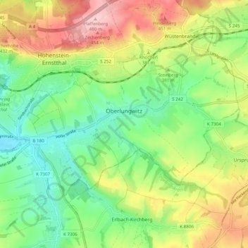
Name: Oberlungwitz topographic map, elevation, terrain.
Location: Oberlungwitz, Zwickau, Sachsen, 09353, Deutschland (50.76845 12.68277 50.80390 12.77886)
Average elevation: 1,165 ft
Minimum elevation: 915 ft
Maximum elevation: 1,581 ft
Thank you for supporting this site ❤️
Make a donation
Make a donation
Gear up for your next adventure:
As an Amazon Associate, this site earns from qualifying purchases at no extra cost to you.