
Thank you for supporting this site ❤️
Make a donation
Make a donation
Gear up for your next adventure:
As an Amazon Associate, this site earns from qualifying purchases at no extra cost to you.
Monterrico topographic map
Click on the map to display elevation.
Thank you for supporting this site ❤️
Make a donation
Make a donation
Gear up for your next adventure:
As an Amazon Associate, this site earns from qualifying purchases at no extra cost to you.
About this map
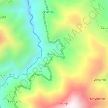
Name: Monterrico topographic map, elevation, terrain.
Location: Monterrico, Ayna, Provincia de La Mar, Ayacucho, Perú (-12.66484 -73.86955 -12.62484 -73.82955)
Average elevation: 4,281 ft
Minimum elevation: 2,556 ft
Maximum elevation: 6,788 ft
Thank you for supporting this site ❤️
Make a donation
Make a donation
Gear up for your next adventure:
As an Amazon Associate, this site earns from qualifying purchases at no extra cost to you.