
Thank you for supporting this site ❤️
Make a donation
Make a donation
Gear up for your next adventure:
As an Amazon Associate, this site earns from qualifying purchases at no extra cost to you.
Tieton topographic map
Click on the map to display elevation.
Thank you for supporting this site ❤️
Make a donation
Make a donation
Gear up for your next adventure:
As an Amazon Associate, this site earns from qualifying purchases at no extra cost to you.
About this map
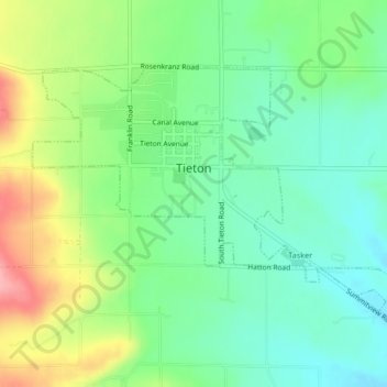
Name: Tieton topographic map, elevation, terrain.
Location: Tieton, Yakima County, Washington, 98947, United States (46.69081 -120.77257 46.70955 -120.73126)
Average elevation: 1,949 ft
Minimum elevation: 1,814 ft
Maximum elevation: 2,195 ft
Washington trails, hiking, mountain biking, running and outdoor activities
Thank you for supporting this site ❤️
Make a donation
Make a donation
Gear up for your next adventure:
As an Amazon Associate, this site earns from qualifying purchases at no extra cost to you.