Geolocate

Windrow topographic map

Click on the map to display elevation.

About this map

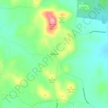
Name: Windrow topographic map, elevation, terrain.

Location: Windrow, Rutherford County, Tennessee, 37153, United States (35.77864 -86.57490 35.81864 -86.53490)

Average elevation: 830 ft

Minimum elevation: 676 ft

Maximum elevation: 1,152 ft

Gear up for your next adventure:

🛠️Outdoor Gear Repair Kit - Essential tools to fix gear on the trail
🪶Fire Starter Kit - Reliable fire starter for survival and camping
🔥Fast-Boil Camping Stoves - Efficient cooking systems for quick trail meals
📦Dry Bags Set - Waterproof storage for electronics and clothes
🎒Gear Packing Cubes - Organize your backpack efficiently

As an Amazon Associate, this site earns from qualifying purchases at no extra cost to you.