
Thank you for supporting this site ❤️
Make a donation
Make a donation
Gear up for your next adventure:
As an Amazon Associate, this site earns from qualifying purchases at no extra cost to you.
Muang Kham topographic map
Click on the map to display elevation.
Thank you for supporting this site ❤️
Make a donation
Make a donation
Gear up for your next adventure:
As an Amazon Associate, this site earns from qualifying purchases at no extra cost to you.
About this map
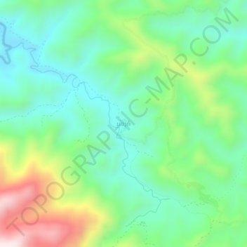
Name: Muang Kham topographic map, elevation, terrain.
Location: Muang Kham, Phou Kout District, Xiangkhouang Province, Laos (19.81766 103.22891 19.85766 103.26891)
Average elevation: 2,500 ft
Minimum elevation: 1,854 ft
Maximum elevation: 3,940 ft
Thank you for supporting this site ❤️
Make a donation
Make a donation
Gear up for your next adventure:
As an Amazon Associate, this site earns from qualifying purchases at no extra cost to you.