Geolocate

Famenne topographic map

Click on the map to display elevation.

About this map

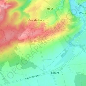
Name: Famenne topographic map, elevation, terrain.

Location: Famenne, Hour, Houyet, Dinant, Namur, Wallonie, 5563, Belgique (50.12525 5.01216 50.16525 5.05216)

Average elevation: 545 ft

Minimum elevation: 407 ft

Maximum elevation: 764 ft

Gear up for your next adventure:

🎒Day Hiking Backpack - Lightweight backpack perfect for day trips and outdoor adventures
🧴Hand Sanitizer - Keep hands clean while hiking
🪶Fire Starter Kit - Reliable fire starter for survival and camping
📶Vehicle Signal Boosters - Improve reception in rural areas while driving to trailheads
🧦Merino Wool Socks - Moisture-wicking, blister-preventing socks for long treks

As an Amazon Associate, this site earns from qualifying purchases at no extra cost to you.