
Thank you for supporting this site ❤️
Make a donation
Make a donation
Gear up for your next adventure:
As an Amazon Associate, this site earns from qualifying purchases at no extra cost to you.
Adelong topographic map
Click on the map to display elevation.
Thank you for supporting this site ❤️
Make a donation
Make a donation
Gear up for your next adventure:
As an Amazon Associate, this site earns from qualifying purchases at no extra cost to you.
About this map
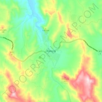
Name: Adelong topographic map, elevation, terrain.
Location: Adelong, Snowy Valleys Council, New South Wales, Australia (-35.34749 148.02315 -35.26749 148.10315)
Average elevation: 1,401 ft
Minimum elevation: 846 ft
Maximum elevation: 2,290 ft
Thank you for supporting this site ❤️
Make a donation
Make a donation
Gear up for your next adventure:
As an Amazon Associate, this site earns from qualifying purchases at no extra cost to you.