Geolocate

Boonah topographic map

Click on the map to display elevation.

About this map

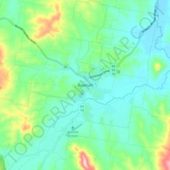
Name: Boonah topographic map, elevation, terrain.

Location: Boonah, Scenic Rim Regional, Queensland, Australia (-28.03690 152.64196 -27.95690 152.72196)

Average elevation: 427 ft

Minimum elevation: 226 ft

Maximum elevation: 1,043 ft

Other topographic maps

Click on a map to view its topography, its elevation and its terrain.

Boonah

Australia > Queensland > Boonah

Average elevation: 364 ft

Gear up for your next adventure:

🎒Trekking Poles - Sturdy poles for balance and stability on rough terrain
🧦Merino Wool Socks - Moisture-wicking, blister-preventing socks for long treks
🏕️Tent Footprint - Protect your tent base from wear
☀️Outdoor Sunscreen - High protection sunscreen for outdoor activities
📦Gear Storage Bags - Organize and protect outdoor equipment

As an Amazon Associate, this site earns from qualifying purchases at no extra cost to you.