Geolocate

Hinesville topographic map

Click on the map to display elevation.

About this map

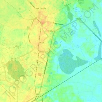
Name: Hinesville topographic map, elevation, terrain.

Location: Hinesville, Liberty County, Georgia, 31313, United States (31.78243 -81.67212 31.87372 -81.55517)

Average elevation: 52 ft

Minimum elevation: 0 ft

Maximum elevation: 128 ft

Liberty County trails, hiking, mountain biking, running and outdoor activities

Other topographic maps

Click on a map to view its topography, its elevation and its terrain.

Fleming

United States > Georgia > Liberty County

Average elevation: 16 ft

Seabrook

United States > Georgia > Liberty County

Average elevation: 23 ft

Gear up for your next adventure:

🛡️Bear Spray Outdoor - Protection in bear country hikes
🛶Inflatable Kayak - Portable kayak for rivers, lakes, and expeditions
👖Convertible Hiking Pants - Versatile zip-off pants for changing altitudes and temperatures
🎒Waterproof Dry Bags - Keep your electronics and maps dry inside your pack
🥤Water Filter Bottle - All‑in‑one filter bottle for safe hydration

As an Amazon Associate, this site earns from qualifying purchases at no extra cost to you.