
Make a donation
Gear up for your next adventure:
As an Amazon Associate, this site earns from qualifying purchases at no extra cost to you.
Rhein topographic map
Click on the map to display elevation.
Make a donation
Gear up for your next adventure:
As an Amazon Associate, this site earns from qualifying purchases at no extra cost to you.
Rhein
Bei Tamins-Reichenau vereinigen sich Vorder- und Hinterrhein zum Alpenrhein. Auf kaum 86 Kilometern Länge fällt er von 599 auf 396 Meter Höhe. Der Rhein knickt zunächst bei Chur, der Hauptstadt Graubündens, markant nach Norden ab. Das Rheintal ist ein glazial geprägtes, breit ausgeräumtes, alpines Kastental. Bei Sargans verhindert nur eine wenige Meter hohe Landstufe, dass der Rhein durch das offene Seeztal durch Walensee und Zürichsee in Richtung Aare fließt. Unterhalb davon ist sein Westufer schweizerisch, im Osten grenzen Liechtenstein und dann Österreich an.
Make a donation
Gear up for your next adventure:
As an Amazon Associate, this site earns from qualifying purchases at no extra cost to you.
About this map
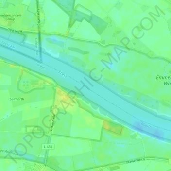
Name: Rhein topographic map, elevation, terrain.
Average elevation: 46 ft
Minimum elevation: 23 ft
Maximum elevation: 72 ft
Make a donation
Gear up for your next adventure:
As an Amazon Associate, this site earns from qualifying purchases at no extra cost to you.