Geolocate

Kilkivan topographic map

Click on the map to display elevation.

About this map

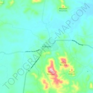
Name: Kilkivan topographic map, elevation, terrain.

Location: Kilkivan, Gympie Regional, Queensland, Australia (-26.12571 152.19716 -26.04571 152.27716)

Average elevation: 528 ft

Minimum elevation: 328 ft

Maximum elevation: 1,440 ft

Other topographic maps

Click on a map to view its topography, its elevation and its terrain.

Kilkivan

Australia > Queensland > Kilkivan

Average elevation: 702 ft

Gear up for your next adventure:

🍳Camping Cook Set - Complete cookware for outdoor meals
🖼️Topo Map Wall Art - Decorative topographic prints of famous peaks and regions
📚USA Hiking Guide Books - Top trail guides and map books
📦Dry Bags Set - Waterproof storage for electronics and clothes
🧺Microfiber Travel Towels - Compact and fast-drying towels for trail use

As an Amazon Associate, this site earns from qualifying purchases at no extra cost to you.