
Knaphill topographic map
Click on the map to display elevation.
About this map
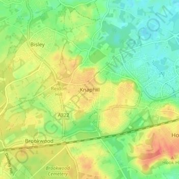
Name: Knaphill topographic map, elevation, terrain.
Location: Knaphill, Woking, Surrey, England, GU21 2DG, United Kingdom (51.29638 -0.63691 51.33638 -0.59691)
Average elevation: 141 ft
Minimum elevation: 66 ft
Maximum elevation: 226 ft
Other topographic maps
Click on a map to view its topography, its elevation and its terrain.
Horsell Common
United Kingdom > England > Surrey > Woking > Horsell > Durnford Farm
Average elevation: 95 ft
Brookwood Country Park
United Kingdom > England > Surrey > Woking > Knaphill
Average elevation: 154 ft