
Blackdown topographic map
Click on the map to display elevation.
About this map
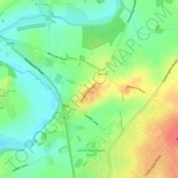
Name: Blackdown topographic map, elevation, terrain.
Location: Blackdown, Warwick, Warwickshire, England, United Kingdom (52.30908 -1.55760 52.32630 -1.52110)
Average elevation: 226 ft
Minimum elevation: 154 ft
Maximum elevation: 325 ft
Other topographic maps
Click on a map to view its topography, its elevation and its terrain.
Rowington Green
United Kingdom > England > Warwickshire > Warwick > Rowington
Average elevation: 374 ft
Hampton on the Hill
United Kingdom > England > Warwickshire > Warwick > Hampton on the Hill
Average elevation: 246 ft
Hill Wootton
United Kingdom > England > Warwickshire > Warwick > Leek Wootton
Average elevation: 226 ft