
Thank you for supporting this site ❤️
Make a donation
Make a donation
Gear up for your next adventure:
As an Amazon Associate, this site earns from qualifying purchases at no extra cost to you.
Boschplaat topographic map
Click on the map to display elevation.
Thank you for supporting this site ❤️
Make a donation
Make a donation
Gear up for your next adventure:
As an Amazon Associate, this site earns from qualifying purchases at no extra cost to you.
About this map
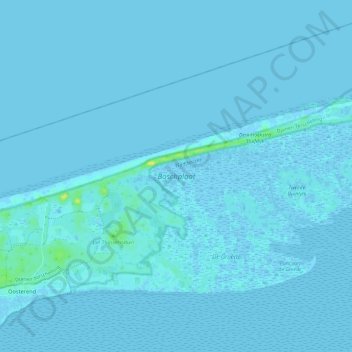
Name: Boschplaat topographic map, elevation, terrain.
Location: Boschplaat, Oosterend, Terschelling, Frisia, Netherlands (53.41338 5.42335 53.44138 5.54159)
Average elevation: 3 ft
Minimum elevation: -13 ft
Maximum elevation: 49 ft
Thank you for supporting this site ❤️
Make a donation
Make a donation
Gear up for your next adventure:
As an Amazon Associate, this site earns from qualifying purchases at no extra cost to you.