
Thank you for supporting this site ❤️
Make a donation
Make a donation
Gear up for your next adventure:
As an Amazon Associate, this site earns from qualifying purchases at no extra cost to you.
Ripponden topographic map
Click on the map to display elevation.
Thank you for supporting this site ❤️
Make a donation
Make a donation
Gear up for your next adventure:
As an Amazon Associate, this site earns from qualifying purchases at no extra cost to you.
About this map
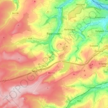
Name: Ripponden topographic map, elevation, terrain.
Location: Ripponden, Calderdale, West Yorkshire, England, United Kingdom (53.61530 -2.05488 53.69337 -1.88866)
Average elevation: 935 ft
Minimum elevation: 226 ft
Maximum elevation: 1,581 ft
Thank you for supporting this site ❤️
Make a donation
Make a donation
Gear up for your next adventure:
As an Amazon Associate, this site earns from qualifying purchases at no extra cost to you.