
Thank you for supporting this site ❤️
Make a donation
Make a donation
Gear up for your next adventure:
As an Amazon Associate, this site earns from qualifying purchases at no extra cost to you.
Belkheir topographic map
Click on the map to display elevation.
Thank you for supporting this site ❤️
Make a donation
Make a donation
Gear up for your next adventure:
As an Amazon Associate, this site earns from qualifying purchases at no extra cost to you.
About this map
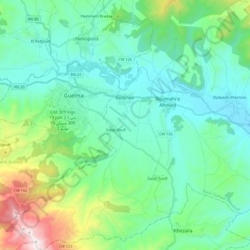
Name: Belkheir topographic map, elevation, terrain.
Location: Belkheir, Guelaat Bou Sbaa District, Guelma, 24100, Algeria (36.35413 7.37785 36.53326 7.52553)
Average elevation: 1,312 ft
Minimum elevation: 440 ft
Maximum elevation: 4,577 ft
Thank you for supporting this site ❤️
Make a donation
Make a donation
Gear up for your next adventure:
As an Amazon Associate, this site earns from qualifying purchases at no extra cost to you.