Geolocate

Biebertal topographic map

Click on the map to display elevation.

About this map

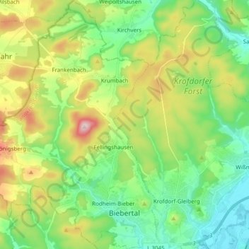
Name: Biebertal topographic map, elevation, terrain.

Location: Biebertal, Landkreis Gießen, Hesse, 35444, Germany (50.60306 8.51923 50.69910 8.62730)

Average elevation: 958 ft

Minimum elevation: 568 ft

Maximum elevation: 1,640 ft

Gear up for your next adventure:

🧥Men's Rain Shells - Premium waterproof and breathable jackets for mountain weather
🪶Survival Guide Book - Expert advice for emergency preparedness
💧Water Filtration Bottles - Safely drink from streams and lakes while exploring
Solar GPS Watches - Advanced multisport watches with built-in topographic maps
🚁Photography Drones - Capture stunning aerial views of landforms and topography

As an Amazon Associate, this site earns from qualifying purchases at no extra cost to you.