Geolocate

Mirit topographic map

Click on the map to display elevation.

About this map

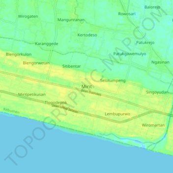
Name: Mirit topographic map, elevation, terrain.

Location: Mirit, Kebumen, Central Java, Java, Indonesia (-7.84121 109.75182 -7.76121 109.83182)

Average elevation: 23 ft

Minimum elevation: 0 ft

Maximum elevation: 52 ft

Gear up for your next adventure:

🧷Carabiner Set - Durable clips for gear attachment
⛑️Personal Locator Beacon - Safety beacon for emergencies
🗃️Trail First Aid Kit - Essential kit for outdoor injuries and emergencies
🌧️Backpack Rain Cover - Keep gear dry in wet weather
🔦LED Headlamp - Bright and durable LED headlamp for night navigation

As an Amazon Associate, this site earns from qualifying purchases at no extra cost to you.