
Make a donation
Gear up for your next adventure:
As an Amazon Associate, this site earns from qualifying purchases at no extra cost to you.
Aghrib topographic map
Click on the map to display elevation.
Make a donation
Gear up for your next adventure:
As an Amazon Associate, this site earns from qualifying purchases at no extra cost to you.
Aghrib
Aghribs is a village and commune in the Kabylie region of Algeria. It is located 40 km north east of Tizi Ouzou and approximately 150 km east of Algiers. The village is at an altitude of 800 metres above sea level and at a distance of 10 km from the Mediterranean Sea.
Make a donation
Gear up for your next adventure:
As an Amazon Associate, this site earns from qualifying purchases at no extra cost to you.
About this map
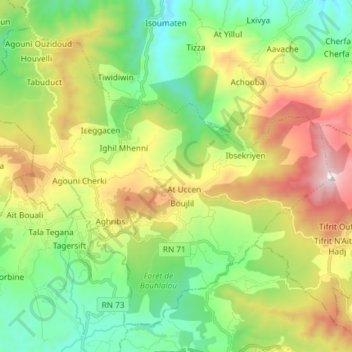
Name: Aghrib topographic map, elevation, terrain.
Location: Aghrib, Azeffoun District, Tizi Ouzou, 15022, Algeria (36.76913 4.26850 36.87015 4.41604)
Average elevation: 1,398 ft
Minimum elevation: 131 ft
Maximum elevation: 3,163 ft
Make a donation
Gear up for your next adventure:
As an Amazon Associate, this site earns from qualifying purchases at no extra cost to you.