Geolocate

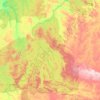
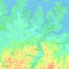
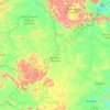
Amazon River topographic map

Click on the map to display elevation.

Amazon River

During what many archaeologists called the formative stage, Amazonian societies were deeply involved in the emergence of South America's highland agrarian systems. The trade with Andean civilizations in the terrains of the headwaters in the Andes formed an essential contribution to the social and religious development of higher-altitude civilizations like the Muisca and Incas. Early human settlements were typically based on low-lying hills or mounds.

Wikipedia (CC-BY-SA 3.0)

About this map

Name: Amazon River topographic map, elevation, terrain.

Location: Amazon River, Região Geográfica Intermediária de Altamira, Pará, North Region, Brazil (-1.57905 -52.68321 -1.35789 -52.09909)

Average elevation: 62 ft

Minimum elevation: -13 ft

Maximum elevation: 869 ft

Other topographic maps

Click on a map to view its topography, its elevation and its terrain.

Novo Progresso

Brazil > Pará

Average elevation: 1,001 ft

Oriximiná

Brazil > Pará > Oriximiná

Average elevation: 709 ft

Santarém

Brazil > Pará

Average elevation: 279 ft

Óbidos

Brazil > Pará

Average elevation: 778 ft

Belém

Brazil > Pará

Average elevation: 20 ft

Belém

Brazil > Pará

Average elevation: 20 ft

Altamira

Brazil > Pará

The first administrative elevation took place on April 14, 1874, when the municipality of Souzel (now Senator José Porfírio) was created, where the Tavaquara Mission (Altamira) was elevated to the status of village. During this period the village survived from the extraction and commercialization of rubber…

Average elevation: 768 ft
Aratau

Brazil > Pará > Pacajá

Average elevation: 262 ft

Bragança

Brazil > Pará

Average elevation: 85 ft

Serra Pelada

Brazil > Pará > Curionópolis

Average elevation: 1,037 ft

Tailândia

Brazil > Pará

Average elevation: 141 ft

Nossa Senhora

Brazil > Pará > Rurópolis

Average elevation: 305 ft

Ilha Charapucu

Brazil > Pará

Average elevation: 13 ft

Belém

Brazil > Pará

Average elevation: 20 ft

São Geraldo do Araguaia

Brazil > Pará

Average elevation: 568 ft

Philadelfia

Brazil > Pará > Itaituba

Average elevation: 46 ft

Tomé-Açu

Brazil > Pará

Average elevation: 157 ft

Afuá

Brazil > Pará

Average elevation: 13 ft

Belém

Brazil > Pará

Average elevation: 20 ft

Cachoeira do Arari

Brazil > Pará > Cachoeira do Arari

Average elevation: 16 ft

Anajás

Brazil > Pará

Average elevation: 23 ft

Juruti

Brazil > Pará

Average elevation: 177 ft

Porto de Moz

Brazil > Pará

Average elevation: 135 ft

Dom Eliseu

Brazil > Pará

Dom Eliseu is a municipality in the state of Pará in the Northern region of Brazil. At an altitude of 180 meters, its estimated population in 2021 is around 61,206. Because of its status as a trading post and sales from wood, seeds, straw, guava and other factors, Dom Eliseu has a dynamic commercial and…

Average elevation: 640 ft

Barcarena

Brazil > Pará

Average elevation: 20 ft

São Félix do Xingu

Brazil > Pará

Average elevation: 925 ft

Capanema

Brazil > Pará

'Capanema' is a municipality in the state of Pará. It is located at a latitude 01 ° 11'45 "South and longitude 47 ° 10'51" west, with an altitude of 24 meters. Its population in 2020 was 69,431 inhabitants. Despite being a city average, requires great influence in the region in trade and services. A…

Average elevation: 105 ft

Muaná

Brazil > Pará

Average elevation: 16 ft

Marabá

Brazil > Pará

The topography of the municipality of Marabá presents the highest altitudes in the Southeast region of Pará, through the Carajás, Sereno, Buritirama, Paredão, Encontro, Gray and Misteriosa mountains. Of this complex, stands out the Carajás mountain range, like the one of greater size. However, it is in…

Average elevation: 597 ft

Guimar

Brazil > Pará > Goianésia do Pará

Average elevation: 295 ft

Soure

Brazil > Pará

Average elevation: 7 ft

Xinguara

Brazil > Pará

Average elevation: 889 ft

Igarapé-Miri

Brazil > Pará

Average elevation: 36 ft

Marabá

Brazil > Pará

The topography of the municipality of Marabá presents the highest altitudes in the Southeast region of Pará, through the Carajás, Sereno, Buritirama, Paredão, Encontro, Gray and Misteriosa mountains. Of this complex, stands out the Carajás mountain range, like the one of greater size. However, it is in…

Average elevation: 597 ft

Itaituba

Brazil > Pará

Average elevation: 659 ft

Floresta do Araguaia

Brazil > Pará

Average elevation: 659 ft

Belém

Brazil > Pará

Average elevation: 20 ft

Almeirim

Brazil > Pará

Average elevation: 515 ft

Chaves

Brazil > Pará

Average elevation: 10 ft

Tucumã

Brazil > Pará

Average elevation: 994 ft

Nova Betel

Brazil > Pará > Irituia

Average elevation: 115 ft

Santarém

Brazil > Pará

Average elevation: 279 ft

Santarém

Brazil > Pará

Average elevation: 279 ft

Trios

Brazil > Pará > Almeirim

Average elevation: 1,175 ft

Tomé-Açu

Brazil > Pará

Average elevation: 157 ft

Itupiranga

Brazil > Pará

Average elevation: 417 ft

Prainha

Brazil > Pará

Prainha is a municipality in the state of Pará in Brazil. The population is 29,846 (2020 est.) in an area of 14,787 km². The elevation is 70 m. It is located on the Amazon River.

Average elevation: 338 ft

Altamira

Brazil > Pará

The first administrative elevation took place on April 14, 1874, when the municipality of Souzel (now Senator José Porfírio ) was created, where the Tavaquara Mission (Altamira) was elevated to the status of village. During this period the village survived from the extraction and commercialization of rubber…

Average elevation: 768 ft
Santa Maria das Barreiras

Brazil > Pará

Average elevation: 663 ft

Belém

Brazil > Pará

Average elevation: 20 ft

Babacu

Brazil > Pará > Santarém

Average elevation: 33 ft

Belém

Brazil > Pará

Average elevation: 20 ft

Ananindeua

Brazil > Pará

Average elevation: 30 ft

Curralinho

Brazil > Pará

Average elevation: 23 ft

Marapanim

Brazil > Pará

Average elevation: 52 ft

Jacundá

Brazil > Pará

Average elevation: 381 ft

Rondon do Pará

Brazil > Pará

Average elevation: 705 ft

Barcarena

Brazil > Pará

Average elevation: 20 ft

Carajas

Brazil > Pará > Novo Repartimento

Average elevation: 600 ft

Redenção

Brazil > Pará

Average elevation: 719 ft

Salinópolis

Brazil > Pará

Average elevation: 43 ft

Curuá

Brazil > Pará

Average elevation: 121 ft

Almeirim

Brazil > Pará

Average elevation: 515 ft

Castanhal

Brazil > Pará

Average elevation: 98 ft

Tucuruí

Brazil > Pará

Average elevation: 272 ft

Jacareacanga

Brazil > Pará

Average elevation: 653 ft

Rio Maria

Brazil > Pará

Average elevation: 883 ft

Conceição do Araguaia

Brazil > Pará > Araguaia River

Average elevation: 640 ft

Nova Ipixuna

Brazil > Pará

Average elevation: 390 ft

Riogrande

Brazil > Pará > São Caetano de Odivelas

Average elevation: 69 ft

Pot Kro

Brazil > Pará > Anapu

Average elevation: 361 ft

Santarém

Brazil > Pará

Average elevation: 279 ft

Aveiro

Brazil > Pará

Average elevation: 423 ft

Bragança

Brazil > Pará > Bragança

Average elevation: 39 ft

Jandiá

Brazil > Pará > Tracuateua

Average elevation: 62 ft

Ilha Mucurás

Brazil > Pará > Barcarena

Average elevation: 16 ft

Oriximiná

Brazil > Pará

Average elevation: 830 ft

Ourilândia do Norte

Brazil > Pará

Average elevation: 1,050 ft

Marajo

Brazil > Pará > Santarém

Average elevation: 10 ft

Água Azul do Norte

Brazil > Pará

Average elevation: 1,066 ft

Itaituba

Brazil > Pará

Average elevation: 659 ft

Gear up for your next adventure:

🔋Solar Power Banks - Keep your GPS and phone charged in remote wilderness areas
🛰️Satellite Messengers - Emergency SOS and two-way messaging for off-grid adventures
🌎3D Topographic Globes - Raised relief globes for a tactile understanding of geography
🪶Survival Guide Book - Expert advice for emergency preparedness
📶Vehicle Signal Boosters - Improve reception in rural areas while driving to trailheads

As an Amazon Associate, this site earns from qualifying purchases at no extra cost to you.