
Thank you for supporting this site ❤️
Make a donation
Make a donation
Gear up for your next adventure:
As an Amazon Associate, this site earns from qualifying purchases at no extra cost to you.
Petralia topographic map
Click on the map to display elevation.
Thank you for supporting this site ❤️
Make a donation
Make a donation
Gear up for your next adventure:
As an Amazon Associate, this site earns from qualifying purchases at no extra cost to you.
About this map
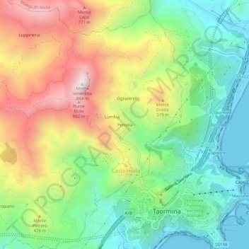
Name: Petralia topographic map, elevation, terrain.
Location: Petralia, Castelmola, Messina, Sicilia, 98030, Italia (37.84570 15.25710 37.88570 15.29710)
Average elevation: 1,145 ft
Minimum elevation: 0 ft
Maximum elevation: 2,881 ft
Thank you for supporting this site ❤️
Make a donation
Make a donation
Gear up for your next adventure:
As an Amazon Associate, this site earns from qualifying purchases at no extra cost to you.