Geolocate

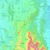
Gannoruwa topographic map

Click on the map to display elevation.

About this map

Name: Gannoruwa topographic map, elevation, terrain.

Location: Gannoruwa, Kandy District, Central Province, 20400, Sri Lanka (7.26245 80.57253 7.30245 80.61253)

Average elevation: 1,739 ft

Minimum elevation: 1,447 ft

Maximum elevation: 2,454 ft

Other topographic maps

Click on a map to view its topography, its elevation and its terrain.
Horton Plains National Park

Sri Lanka > Central Province > Nuwara Eliya

Horton Plains National Park (Sinhala: හෝර්ටන් තැන්න ජාතික උද්‍යානය, romanized: Hortan Thanna Jathika Udyanaya) is a national park in the central highlands of Sri Lanka that was designated in 1988. It encompasses an area of 31 km2 (12 sq mi) and borders…

Average elevation: 6,594 ft
Kandy District

Sri Lanka > Central Province

Average elevation: 2,405 ft

Matale District

Sri Lanka > Central Province

Average elevation: 886 ft

Nuwara Eliya District

Sri Lanka > Central Province

Average elevation: 3,586 ft

Matale District

Sri Lanka > Central Province

Average elevation: 886 ft

Kandy District

Sri Lanka > Central Province

Average elevation: 2,405 ft

Matale District

Sri Lanka > Central Province

Average elevation: 886 ft

Sigiriya

Sri Lanka > Central Province

Average elevation: 666 ft

Nanu Oya

Sri Lanka > Central Province > Nanu Oya

Average elevation: 5,869 ft

Nuwara Eliya District

Sri Lanka > Central Province

Average elevation: 3,586 ft

Horton Plains National Park

Sri Lanka > Central Province

Horton Plains National Park (Sinhala: හෝර්ටන් තැන්න ජාතික උද්‍යානය, romanized: Hortan Thanna Jathika Udyanaya) is a national park in the central highlands of Sri Lanka that was designated in 1988. It is located at an elevation of 2,100–2,300 m (6,900–7,500…

Average elevation: 6,594 ft

Kandy District

Sri Lanka > Central Province

Average elevation: 2,405 ft

Horton Plains National Park

Sri Lanka > Central Province

Horton Plains National Park (Sinhala: හෝර්ටන් තැන්න ජාතික උද්‍යානය, romanized: Hortan Thanna Jathika Udyanaya) is a national park in the central highlands of Sri Lanka that was designated in 1988. It covers an area of 31km² and borders Thotupalakanda Nature…

Average elevation: 6,594 ft
Upper Kotmale Dam

Sri Lanka > Central Province > Talawakele > Holyrood

Average elevation: 4,098 ft

Matale District

Sri Lanka > Central Province

Average elevation: 886 ft

Gear up for your next adventure:

🔋Rechargeable Batteries - Power up your outdoor devices
🎒Trail Energy Bars - High‑calorie bars for hiking energy
🛌Ultralight Sleeping Bags - Compact down bags for cold nights in the wilderness
🎒Day Hiking Backpack - Lightweight backpack perfect for day trips and outdoor adventures
🪓Survival Multi‑Tool - Versatile tool for camp and trail tasks

As an Amazon Associate, this site earns from qualifying purchases at no extra cost to you.