
Maddela topographic map
Click on the map to display elevation.
About this map
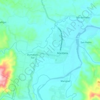
Name: Maddela topographic map, elevation, terrain.
Location: Maddela, Quirino, Cagayan Valley, 3404, Philippines (16.30026 121.64312 16.38026 121.72312)
Average elevation: 620 ft
Minimum elevation: 371 ft
Maximum elevation: 1,781 ft
Other topographic maps
Click on a map to view its topography, its elevation and its terrain.