Geolocate

Grad Vodice topographic map

Click on the map to display elevation.

About this map

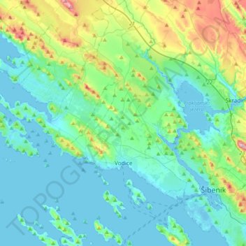
Name: Grad Vodice topographic map, elevation, terrain.

Location: Grad Vodice, Šibenik-Knin County, Croatia (43.68012 15.73503 43.91446 15.85938)

Average elevation: 213 ft

Minimum elevation: -23 ft

Maximum elevation: 1,096 ft

Gear up for your next adventure:

🪶Fire Starter Kit - Reliable fire starter for survival and camping
🧢Sun Protection Hats - Wide-brimmed and UPF-rated hats for high-altitude sun safety
🧭Pro Hiking Compasses - High-accuracy liquid-filled compasses for topographic orientation
🔥Plasma Lighters - Windproof lighters that work in any weather condition
🎒Day Hiking Backpack - Lightweight backpack perfect for day trips and outdoor adventures

As an Amazon Associate, this site earns from qualifying purchases at no extra cost to you.