
Neuruppin topographic map
Click on the map to display elevation.
About this map
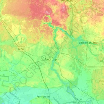
Name: Neuruppin topographic map, elevation, terrain.
Average elevation: 177 ft
Minimum elevation: 85 ft
Maximum elevation: 377 ft
Other topographic maps
Click on a map to view its topography, its elevation and its terrain.
North European Plain
Germany > Brandenburg > Ostprignitz-Ruppin > Lindow (Mark) > Banzendorf
Elevations vary between 0 and 200 m (0 to about 650 ft). While mostly used as farmland, the region also contains bogs, heath and lakes. The Wadden Sea, a large tidal area, is located on the North Sea coast.
Average elevation: 177 ft