
Thank you for supporting this site ❤️
Make a donation
Make a donation
Gear up for your next adventure:
As an Amazon Associate, this site earns from qualifying purchases at no extra cost to you.
Ribafria topographic map
Click on the map to display elevation.
Thank you for supporting this site ❤️
Make a donation
Make a donation
Gear up for your next adventure:
As an Amazon Associate, this site earns from qualifying purchases at no extra cost to you.
About this map
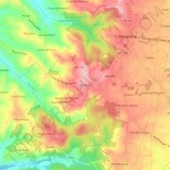
Name: Ribafria topographic map, elevation, terrain.
Location: Ribafria, Benedita, Alcobaça, Leiria, 2475-040, Portugal (39.39427 -9.01311 39.43427 -8.97311)
Average elevation: 568 ft
Minimum elevation: 253 ft
Maximum elevation: 781 ft
Thank you for supporting this site ❤️
Make a donation
Make a donation
Gear up for your next adventure:
As an Amazon Associate, this site earns from qualifying purchases at no extra cost to you.