Geolocate

Nathan topographic map

Click on the map to display elevation.

About this map

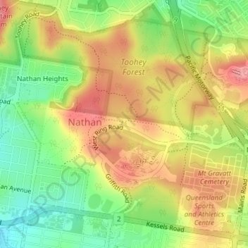
Name: Nathan topographic map, elevation, terrain.

Location: Nathan, City of Brisbane, Queensland, 4111, Australia (-27.56084 153.03903 -27.53630 153.06767)

Average elevation: 223 ft

Minimum elevation: 43 ft

Maximum elevation: 387 ft

Other topographic maps

Click on a map to view its topography, its elevation and its terrain.

Bulimba Creek

Australia > Queensland > City of Brisbane

Average elevation: 36 ft

Tangalooma

Australia > Queensland > City of Brisbane

Average elevation: 135 ft

Enoggera Hill

Australia > Queensland > City of Brisbane

Average elevation: 374 ft

Toohey Mountain

Australia > Queensland > City of Brisbane

Average elevation: 174 ft

Enoggera Dam

Australia > Queensland > City of Brisbane

Average elevation: 295 ft

Wilcannia Park

Australia > Queensland > City of Brisbane

Average elevation: 249 ft

Blunder Creek

Australia > Queensland > City of Brisbane

Average elevation: 85 ft

Tangalooma

Australia > Queensland > City of Brisbane

Average elevation: 135 ft

Timberland Park

Australia > Queensland > City of Brisbane

Average elevation: 121 ft

Deepwater Bend

Australia > Queensland > City of Brisbane

Average elevation: 16 ft

Gear up for your next adventure:

🪶Survival Guide Book - Expert advice for emergency preparedness
🎒Gear Packing Cubes - Organize your backpack efficiently
📶Vehicle Signal Boosters - Improve reception in rural areas while driving to trailheads
🧦Merino Wool Socks - Moisture-wicking, blister-preventing socks for long treks
🧢Sun Protection Hats - Wide-brimmed and UPF-rated hats for high-altitude sun safety

As an Amazon Associate, this site earns from qualifying purchases at no extra cost to you.