Geolocate

Bugay topographic map

Click on the map to display elevation.

About this map

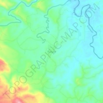
Name: Bugay topographic map, elevation, terrain.

Location: Bugay, Bayawan, Negros Oriental, Central Visayas, Philippines (9.60982 122.81347 9.64982 122.85347)

Average elevation: 571 ft

Minimum elevation: 433 ft

Maximum elevation: 958 ft

Gear up for your next adventure:

📖Nature Tracking Books - Learn to track wildlife and terrain
Camping Coffee Makers - Enjoy premium coffee at the summit or campsite
🎒Day Hiking Backpack - Lightweight backpack perfect for day trips and outdoor adventures
🧣Merino Neck Gaiters - Multi-functional headwear for wind and sun protection
🥾Women's Hiking Boots - Top-rated trail boots with ankle support and superior grip

As an Amazon Associate, this site earns from qualifying purchases at no extra cost to you.