Geolocate

Barrigada topographic map

Click on the map to display elevation.

About this map

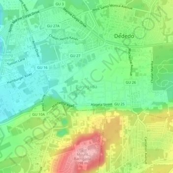
Name: Barrigada topographic map, elevation, terrain.

Location: Barrigada, Dededo Municipality, Guam, 96929, United States (13.48500 144.81016 13.52500 144.85016)

Average elevation: 338 ft

Minimum elevation: 144 ft

Maximum elevation: 673 ft

Guam trails, hiking, mountain biking, running and outdoor activities

Gear up for your next adventure:

📌Outdoor GPS Map App - Apps and devices for digital topographic navigation
Backpacking Tents - Weight-optimized shelters for multi-day topographic surveys
🪶Camping Sleeping Pad - Comfortable sleeping pad for backpacking
🪑Ultralight Camp Chairs - Portable seating for resting after a long day of mapping
😴Insulated Sleeping Pads - Compact and warm pads for high-elevation camping

As an Amazon Associate, this site earns from qualifying purchases at no extra cost to you.