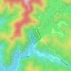
Katashina topographic map
Click on the map to display elevation.
Katashina
Located in northern Gunma, Katashina is bordered by Tochigi Prefecture to the east and Fukushima Prefecture to the northeast. The village is very mountainous, with the highest elevation being 2578 m and the lowest 640 m. The temperature can reach up to 36 °C in the summer, but in the winter, it can drop to -18 °C. The average temperature is 11 °C, the yearly precipitation is 1042 mm, and amount of snowfall is 95 cm, with the snowy period lasting for 120 days.
About this map

Name: Katashina topographic map, elevation, terrain.
Location: Katashina, Tone County, Gunma Prefecture, Japan (36.70963 139.13909 36.96452 139.40670)
Average elevation: 4,596 ft
Minimum elevation: 1,857 ft
Maximum elevation: 8,409 ft
Other topographic maps
Click on a map to view its topography, its elevation and its terrain.

Mount Hotaka
Japan > Tone County > Kawaba
Mount Hotaka (武尊山 Hotakayama, 上州武尊山 Joshu Hotakayama) is a stratovolcano with its highest peak at the altitude of 2,158m. It is located near Minakami-machi, Kawaba Village, and Katashina Village in the Gunma Prefecture. In order to distinguish it from Mount Hotakadake in the Northern Alps, it…
Average elevation: 5,889 ft