Geolocate

Stack Rock topographic map

Click on the map to display elevation.

About this map

Name: Stack Rock topographic map, elevation, terrain.

Location: Stack Rock, Angle, Pembrokeshire, Wales, United Kingdom (51.70224 -5.09263 51.70286 -5.09162)

Average elevation: 20 ft

Minimum elevation: 0 ft

Maximum elevation: 184 ft

Other topographic maps

Click on a map to view its topography, its elevation and its terrain.
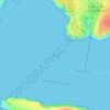
Stack Rock Fort

United Kingdom > Wales > Pembrokeshire > Angle

Average elevation: 20 ft

Gear up for your next adventure:

🌐World Map Poster - Decorative world maps with topographic info
🔌Solar Panel Charger - Charge gear sustainably outdoors
🔦Powerful Headlamps - Ultra-bright hands-free lighting for night navigation
🎒Day Hiking Backpack - Lightweight backpack perfect for day trips and outdoor adventures
🧼Biodegradable Camping Soap - Eco‑friendly soap for outdoor hygiene

As an Amazon Associate, this site earns from qualifying purchases at no extra cost to you.