Geolocate

Roxwell topographic map

Click on the map to display elevation.

About this map

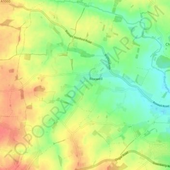
Name: Roxwell topographic map, elevation, terrain.

Location: Roxwell, Chelmsford, Essex, England, United Kingdom (51.72227 0.34109 51.77622 0.41532)

Average elevation: 184 ft

Minimum elevation: 98 ft

Maximum elevation: 276 ft

Gear up for your next adventure:

Solar GPS Watches - Advanced multisport watches with built-in topographic maps
🛶Inflatable Kayak - Portable kayak for rivers, lakes, and expeditions
🔪Outdoor Multitools - Essential survival tools for gear repair and field use
🧦Merino Wool Socks - Moisture-wicking, blister-preventing socks for long treks
🥘Titanium Cookware - Durable, featherlight pots and pans for backpacking

As an Amazon Associate, this site earns from qualifying purchases at no extra cost to you.