Geolocate

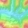
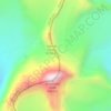
Bakria topographic map

Click on the map to display elevation.

About this map

Name: Bakria topographic map, elevation, terrain.

Location: Bakria, Bhatwari, Uttarkashi, Uttarakhand, India (30.82287 78.54105 30.82297 78.54115)

Average elevation: 11,129 ft

Minimum elevation: 9,396 ft

Maximum elevation: 12,477 ft

Other topographic maps

Click on a map to view its topography, its elevation and its terrain.

Kyarkoti Lake

India > Uttarakhand > Bhatwari

Average elevation: 13,264 ft

Harsil

India > Uttarakhand > Bhatwari

Average elevation: 9,058 ft

Pari Maatri Taal

India > Uttarakhand > Bhatwari

Average elevation: 14,577 ft

Kedar Tal

India > Uttarakhand > Bhatwari

Average elevation: 15,794 ft

Pulam Sumda

India > Uttarakhand > Bhatwari

Average elevation: 14,997 ft

Gangotri Glacier

India > Uttarakhand > Bhatwari

Average elevation: 17,254 ft

Dayara Bugyal

India > Uttarakhand > Bhatwari

Average elevation: 11,322 ft

Gangotri Glacier

India > Uttarakhand > Bhatwari

Average elevation: 17,254 ft

Kedar Tal

India > Uttarakhand > Bhatwari

Average elevation: 15,794 ft

Kalindi Khal Area

India > Uttarakhand > Bhatwari

Average elevation: 19,216 ft

Harsil

India > Uttarakhand > Bhatwari

Average elevation: 9,058 ft

Gear up for your next adventure:

🪶Wildlife Field Guides - Learn animal tracking and species ID
📡GPS Antenna Upgrade - Enhance GPS reception in remote terrain
⌚Solar GPS Watches - Advanced multisport watches with built-in topographic maps
🪶Survival Guide Book - Expert advice for emergency preparedness
🏕️Tent Footprint - Protect your tent base from wear

As an Amazon Associate, this site earns from qualifying purchases at no extra cost to you.