Geolocate

Mulshi topographic map

Click on the map to display elevation.

About this map
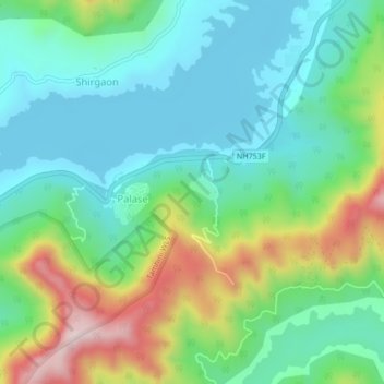
Name: Mulshi topographic map, elevation, terrain.

Location: Mulshi, Mulshi Subdistrict, Pune District, Maharashtra, India (18.48002 73.49374 18.52002 73.53374)

Average elevation: 2,260 ft

Minimum elevation: 1,919 ft

Maximum elevation: 3,760 ft

Other topographic maps

Click on a map to view its topography, its elevation and its terrain.

Temghar dam

India > Maharashtra > Mulshi Subdistrict

Average elevation: 2,444 ft

Mulshi Dam

India > Maharashtra > Mulshi Subdistrict > Sambhave

Average elevation: 1,995 ft

Shirgaon

India > Maharashtra > Mulshi Subdistrict

Average elevation: 2,257 ft

Gear up for your next adventure:

📚USA Hiking Guide Books - Top trail guides and map books
🏕️Tent Footprint - Protect your tent base from wear
🧺Microfiber Travel Towels - Compact and fast-drying towels for trail use
🥤Water Filter Bottle - All‑in‑one filter bottle for safe hydration
🧣Merino Neck Gaiters - Multi-functional headwear for wind and sun protection

As an Amazon Associate, this site earns from qualifying purchases at no extra cost to you.