Geolocate

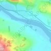
Horn topographic map

Click on the map to display elevation.

About this map

Name: Horn topographic map, elevation, terrain.

Location: Horn, Perth, Perth and Kinross, Scotland, PH2 7SR, United Kingdom (56.40293 -3.23867 56.44293 -3.19867)

Average elevation: 62 ft

Minimum elevation: 23 ft

Maximum elevation: 548 ft

Other topographic maps

Click on a map to view its topography, its elevation and its terrain.

Dupplin Loch

United Kingdom > Scotland > Perth and Kinross > Perth

Average elevation: 427 ft

Elcho Castle

United Kingdom > Scotland > Perth and Kinross > Perth > Rhynd

Average elevation: 125 ft

Dupplin Loch

United Kingdom > Scotland > Perth and Kinross > Perth

Average elevation: 427 ft

Gear up for your next adventure:

🥄Camping Utensil Set - Lightweight utensils for outdoor meals
🎒Waterproof Dry Bags - Keep your electronics and maps dry inside your pack
🧯Emergency Survival Kit - All‑in‑one survival essentials for the backcountry
🚑Emergency Bivvies - Heat-reflective sleeping bags for survival situations
🎁Geography Themed Gifts - Unique gift ideas for map lovers and geography enthusiasts

As an Amazon Associate, this site earns from qualifying purchases at no extra cost to you.