Geolocate

Nanahar topographic map

Click on the map to display elevation.

About this map

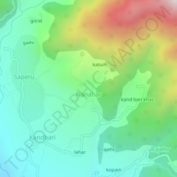
Name: Nanahar topographic map, elevation, terrain.

Location: Nanahar, Palampur, Kangra District, Himachal Pradesh, India (32.11892 76.58310 32.12318 76.58768)

Average elevation: 5,282 ft

Minimum elevation: 4,242 ft

Maximum elevation: 7,608 ft

Other topographic maps

Click on a map to view its topography, its elevation and its terrain.

Panchrukhi

India > Himachal Pradesh > Palampur

Average elevation: 3,428 ft

Bhangiar

India > Himachal Pradesh > Palampur > Maranda

Average elevation: 3,550 ft

Palampur

India > Himachal Pradesh > Palampur

Average elevation: 5,787 ft

Sulah

India > Himachal Pradesh > Palampur

Average elevation: 3,097 ft

Mansimbal

India > Himachal Pradesh > Palampur

Average elevation: 3,176 ft

Gopalpur

India > Himachal Pradesh > Palampur

Average elevation: 4,213 ft

Labankar

India > Himachal Pradesh > Palampur

Average elevation: 4,016 ft

Andreta

India > Himachal Pradesh > Palampur > Agojar

Average elevation: 3,241 ft

Hachher

India > Himachal Pradesh > Palampur > Bandla

Average elevation: 5,036 ft

Salanbari

India > Himachal Pradesh > Palampur > Bhattu

Average elevation: 3,333 ft

jalrehr

India > Himachal Pradesh > Palampur > Banuri

Average elevation: 4,131 ft

matehr

India > Himachal Pradesh > Palampur > Palampur

Average elevation: 3,963 ft

Kalhorkar

India > Himachal Pradesh > Palampur

Average elevation: 3,862 ft

Bhasmehr

India > Himachal Pradesh > Palampur

Average elevation: 4,304 ft

Gujrehra

India > Himachal Pradesh > Palampur

Average elevation: 3,881 ft

bodhala

India > Himachal Pradesh > Palampur

Average elevation: 3,297 ft

Jia

India > Himachal Pradesh > Palampur > Jia

Average elevation: 4,744 ft

Behar

India > Himachal Pradesh > Palampur > Ustehar > Behar

Average elevation: 3,753 ft

Nihang

India > Himachal Pradesh > Palampur > Palampur

Average elevation: 4,075 ft

matehr

India > Himachal Pradesh > Palampur > Palampur

Average elevation: 3,963 ft

Gear up for your next adventure:

🖼️Topo Map Wall Art - Decorative topographic prints of famous peaks and regions
📻Weather Alert Radios - Stay informed of storm risks while off-the-grid
🪶Fire Starter Kit - Reliable fire starter for survival and camping
🌧️Backpack Rain Cover - Keep gear dry in wet weather
🧦Merino Wool Socks - Moisture-wicking, blister-preventing socks for long treks

As an Amazon Associate, this site earns from qualifying purchases at no extra cost to you.