Geolocate

Pisogno topographic map

Click on the map to display elevation.

About this map
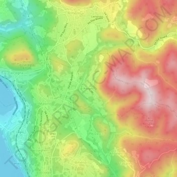
Name: Pisogno topographic map, elevation, terrain.

Location: Pisogno, Miasino, Novara, Piedmont, 28011, Italy (45.78538 8.42388 45.82538 8.46388)

Average elevation: 1,729 ft

Minimum elevation: 942 ft

Maximum elevation: 2,572 ft

Gear up for your next adventure:

🔋Solar Power Banks - Keep your GPS and phone charged in remote wilderness areas
🥘Titanium Cookware - Durable, featherlight pots and pans for backpacking
🔋Rechargeable Batteries - Power up your outdoor devices
🧭Hiking Compass - Precision compass for reliable navigation in the wilderness
🚁Photography Drones - Capture stunning aerial views of landforms and topography

As an Amazon Associate, this site earns from qualifying purchases at no extra cost to you.