
Thank you for supporting this site ❤️
Make a donation
Make a donation
Gear up for your next adventure:
As an Amazon Associate, this site earns from qualifying purchases at no extra cost to you.
Poręba topographic map
Click on the map to display elevation.
Thank you for supporting this site ❤️
Make a donation
Make a donation
Gear up for your next adventure:
As an Amazon Associate, this site earns from qualifying purchases at no extra cost to you.
About this map
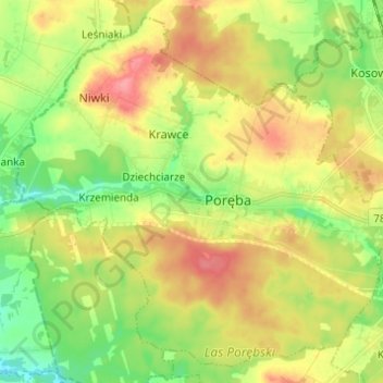
Name: Poręba topographic map, elevation, terrain.
Location: Poręba, Zawiercie County, Silesian Voivodeship, 42-480, Poland (50.45363 19.26989 50.52472 19.39225)
Average elevation: 1,066 ft
Minimum elevation: 948 ft
Maximum elevation: 1,201 ft
Thank you for supporting this site ❤️
Make a donation
Make a donation
Gear up for your next adventure:
As an Amazon Associate, this site earns from qualifying purchases at no extra cost to you.