Geolocate

Teri topographic map

Click on the map to display elevation.

About this map

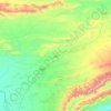
Name: Teri topographic map, elevation, terrain.

Location: Teri, Banda Daud Shah Tehsil, Karak District, Kohat Division, Khyber Pakhtunkhwa, 26390, Pakistan (33.29046 71.08680 33.30905 71.11303)

Average elevation: 2,090 ft

Minimum elevation: 2,024 ft

Maximum elevation: 2,238 ft

Other topographic maps

Click on a map to view its topography, its elevation and its terrain.
Karak

Pakistan > Khyber Pakhtunkhwa > Karak District

Average elevation: 2,152 ft

Gear up for your next adventure:

🕶️GPS Smartphone Mount - Secure mount for phone navigation
🦶Carbon Trekking Poles - Reduce knee impact on steep descents with ultra-light poles
🧤Hiking Gloves - Protective gloves for rugged trails
📦Dry Bags Set - Waterproof storage for electronics and clothes
🧤Tactile Hiking Gloves - Keep hands warm while operating GPS and smartphone screens

As an Amazon Associate, this site earns from qualifying purchases at no extra cost to you.